


Services
Services


Services


The Railway Survey or Station Survey is an investigation to gather data on the proposed route of a railway line. It involves collecting information on the terrain, geography, and existing infrastructure along the proposed route. This data is used to determine the feasibility of the project, identify potential challenges, and inform the design and planning of the railway line. The survey typically includes geological, geotechnical, and environmental assessments to identify potential risks and opportunities. The data collected during the survey is used to create detailed maps, profiles, and models of the proposed route, which are then used to inform the design and construction of the railway line.


Services


")
3D Point Clouds represent a critical aspect of Reality Capture, providing a precise and detailed snapshot of the spatial conditions of a building or space. These point clouds consist of millions of individual points, each accurately positioned in X, Y, and Z coordinates, and often accompanied by greyscale or color information. This comprehensive data capture method is particularly valuable when integrated with modeling softwares.


Services


Contour Survey is surveying the variation in the elevation of the earth’s surface and their relative positions are determined with help of contour lines. The process to find out the contour lines in the ground surface or earth surface is called contouring and a map is produced by this contouring process is called contour map. It is determination of elevation of various points on the land and fixing these points of same horizontal positions in the contour map. In the land property world, a contour is an outline of a mass of land. Main objective of conducting contour surveys is to identify any noticeable difference in elevation of the existing land. In land surveying a contour map is a map illustrated with contour lines, for example a topographic map, which thus shows valleys and hills, and the steepness or gentleness of slopes.


Services


Land Survey is a comprehensive process involves precise measurement, mapping and analysis of piece of land, wheher is a small plot or a vast area. The main objective of a land survey are to establish and document accurate information about land’s physical characterstics, boundries, and features. A land survey combines precise measurements, mapping and legal documentation to establish and verify essential information about a piece of land. It plays a critical role property ownership development and construction, ensuring that everything is accurately represented and in compliance with the law. Surveyors, who are trained professionals, carry out these surveys to provide accurate and reliable data about land properties.


Services
Geological Mapping is a recording of observations on the rock exposures, plotting them on a
base map and logically interpreting the observation towards unraveling their evolutionary history
i.e their mode of origin, diagenesis, metamorphism and the processes that lead to their present deposition.


Services
Geological Modelling essentially concerns developing a description of a rock volume in terms of rock types, brittle/ductile deformations and structures. Even if a key input to such descriptions are observations on site and from boreholes, geological modelling would be impossible without a basic conceptual model. The conceptual model in turn builds on hypotheses on the (long term) geological evolutionary processes.. Precise Geo-CoOrdinates of the pillars in the mining lease area are recorded to carry out the exact survey of all the pillars of the mining lease area using dual frequency DGPS in RTK mode/ETS from the temporary GCP.


")
")
Services

Environmental Impact Assessment (EIA) / Environmental Management Plan (EMP) for grant of Environmental Clearance (EC) from the Competent Authority as per the provisions of EIA Notification, 2006 as amended (We are associated with various QCI NABET Accredited Consulting Organizations of the country for this purpose). Accd. To environmentclearence dot nic dot in. The Environmental Clearance [EC] process for majority of projects will comprise of a maximum of four stages – Screening, Scoping, Public Consultation & Appraisal. EC for developmental projects has been made mandatory by the Ministry of Environment & Forest through its Notification issued on 27/01.


Services
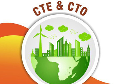
Consent to Establish (CTE): This consent is required to be obtained before establishing any Industry, Plant, Consent to Operate (CTO): Once the Industry, Plant, or Process being established according to mandatory
or Process. The Consent to Establish is the primary clearance.
pollution control systems, the units are required to obtain consent to operate.


Services
Copyright by Vecgroup. All rights reserved.
Copyright by Vecgroup. All rights reserved.
AVANTAGEHeadquarters
ASHOK NAGAR, RANCHI,
JHARKHAND, (834002).OUR LOCATIONSWhere to find us?

AVANTAGEHeadquarters
OUR LOCATIONSWhere to find us?

GET IN TOUCHAvantage Social links